
Keeping Construction Elevations Reliable While the Valley Floor Slowly Moves
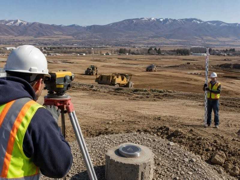
Most construction control assumes the ground holds still. On some valley floors, it does not. Slow settlement can lower benchmarks year after year, quietly enough that nobody notices and steadily enough to matter. A published elevation that was correct when recorded may be wrong today, and a project that trusts it builds that error into everything. Keeping construction elevations reliable on moving ground takes deliberate habits, and the habits start before the first stake goes in.
Selecting Benchmarks Outside the Immediate Work Area
Benchmark selection on stable ground is mostly about convenience. On moving ground it becomes a strategy. The point has to survive the project physically, sit where crews can reach it daily and stand on ground with the best chance of behaving itself.
Distance from the work protects against the obvious threats. Excavation, stockpiles, dewatering and heavy equipment all disturb the ground they touch, so the primary benchmarks belong outside that influence zone. Structure matters too, and a point set on a deep, well-founded feature outranks one on a shallow slab. Independent checking seals the choice. Every benchmark gets verified against other known points before the project trusts it, because a convenient elevation nobody has tested is a liability wearing a brass cap.
Testing Published Elevations Against Current Field Observations
Published values age poorly on settling ground. A benchmark elevation established years ago describes where that point stood then, and the ground may have carried it downward since. Crews that plug historical values straight into project control inherit whatever movement occurred in between.
The remedy is observation before adoption. At project start, the surveyor occupies several published points and measures the relationships between them directly. Points that have moved together reveal themselves through consistent offsets. A point that has moved alone stands out as an outlier, and the comparison flags it before it contaminates anything. The project then adopts values supported by current measurement rather than by publication date, and the control network starts its life anchored to the ground as it exists now.
Building Redundancy Into the Vertical Control Network
One benchmark is a single point of failure. On moving ground, a network is the only defensible design, and the network earns its keep through checks that expose trouble early. Redundancy on these projects takes several working forms:
- Multiple benchmarks distributed around the site, so no single disturbance blinds the project
- Level loops run between them with closures computed and recorded, not just observed
- Regular check shots against secondary points during routine work
- Documented adjustment methods, so every published project value traces to its observations
- A benchmark log recording each point’s history, checks and current status
The payoff is early detection. A point drifting away from its neighbors shows up in the next loop closure instead of in a slab poured at the wrong grade. Networks catch what single points conceal.
Distinguishing Site Settlement From a Survey Control Error
An elevation discrepancy always has two suspects. Either the ground moved or somebody made a mistake, and the two demanded completely different responses. Treating settlement as a blunder wastes the warning. Treating a blunder as settlement corrupts the record.
Separating them takes methodical checking. The crew repeats the observation first, since re-measurement resolves most discrepancies immediately. Equipment gets verified next, because an instrument out of adjustment manufactures phantom movement. Then the suspect point gets compared against several independent references at once.
An error typically involves one measurement and vanishes on repetition. Real settlement persists across repeated observations, shows up from multiple directions and often affects neighboring points in a coherent pattern. The investigation gets documented either way, and the project record shows why each value changed whenever it did.
Updating Crews Without Creating Conflicting Elevation References
Discovering movement creates a communication problem on top of a technical one. The moment a benchmark value changes, every crew still using the old number is building error into the work, and a site where different trades hold different elevations is worse than a site with a single known bias.
Controlled revision keeps the project on one page. Superseded values get retired formally, with the benchmark log recording the old number, the new number and the effective date. Field crews receive the change directly rather than by rumor, drawings and grade sheets referencing the old value get flagged and one person owns the authority to publish elevation changes.
The discipline sounds bureaucratic until the alternative shows up, a foundation crew and a utility crew working three tenths apart and each certain they are right. On moving ground, the paperwork is part of the accuracy.
Frequently Asked Questions
Can a construction benchmark change elevation over time?
Yes. Physical disturbance can shift a point suddenly, and broader ground movement can lower it gradually along with everything around it. Verification at project start and periodic rechecking are how a project learns about the change before the change costs money.
What happens when two benchmarks do not agree?
Work from them stops until the disagreement is explained. The crew repeats observations, checks equipment and brings additional references into the comparison to identify which point moved or which measurement failed. The project then adopts an approved value and documents the resolution.
Should every subcontractor create a separate elevation reference?
No. Uncontrolled benchmarks multiply quietly and drift apart, leaving trades to build to different grades in the same excavation. One coordinated control network, maintained by the surveyor and communicated through a single log, keeps every elevation on the project traceable to the same source.