↓
 

Las Vegas Land Surveying

Local Land Surveyors in Las Vegas, NV

Las Vegas Land Surveying
  • Home
  • ALTA Survey
  • Boundary Surveying
  • Construction Survey
  • Drone LiDAR Mapping
  • Elevation Certificate
  • Land Surveying
  • Lot Survey – Closing Survey
  • Topographic Survey
  • Blog
  • Contact Us
Home 1 2 3 … 9 10 >>

Post navigation

← Older posts

Welcome to Las Vegas Land Surveying

Las Vegas Land Surveying Posted on August 18, 2017 by Las VegasSurveyorApril 15, 2020

Your Final Stop for ALL of Your Survey Needs!                                         Contact us today for a free quote!

This site is intended to provide you with information on Land Surveying in the Las Vegas, NV and Clark area of Nevada. If you’re looking for a Las Vegas Land Surveyor, you’ve come to the right place. If you’d rather talk to someone about your land surveying needs, please call our local number at (702) 718 8776 today. For more information, please continue to read.

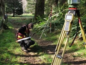
land surveyingLand Surveyors are professionals who make precise measurements to determine the size and boundaries of a piece of real estate.  While this is a simplistic definition, boundary surveying is one of the most common types of surveying related to home and land owners. If you fall into the following categories, please click on the appropriate link for more information on that subject:

Las Vegas Land Surveying services:

    1. I need to know where my property corners or property lines are. (Boundary Survey)
    2. I have a loan closing or re-finance coming up on my home in a subdivision. (Lot Survey)
    3. I need a map of my property with contour lines to show elevation differences for my architect or engineer. (Topo Survey)
    4. I’ve just been told I’m in a flood zone or I’ve been told I need an elevation certificate in order to obtain flood insurance or prove I don’t need it. (Flood Survey)
    5. I’m purchasing a lot/house in a recorded subdivision. (Lot Survey – See Boundary Survey if you’re not in a subdivision.)
    6. I’m purchasing a larger tract of land, acreage, that hasn’t been subdivided in the past. (Boundary Survey)

Contact Las Vegas Land Surveying services TODAY at (702) 718 8776.

Posted in boundary surveying, elevation certificate, land surveying, land surveyor | Tagged boundary survey, land surveyor, land surveyor las-vegas nv, Las Vegas Land Surveying

ALTA Survey Planning Before Buying a Multi-Parcel Commercial Property

Las Vegas Land Surveying Posted on September 4, 2026 by Las VegasSurveyorAugust 29, 2026
Commercial property transaction documents being reviewed before an ALTA survey in Las Vegas, NV.

Buying more than one commercial parcel in a single deal adds steps that a one-lot purchase doesn’t have. Each parcel can carry its own legal description, title record, and set of recorded rights. An alta survey brings that information onto one drawing, but the work runs smoother when the buyer plans ahead. 

Start With a Parcel Schedule Before Ordering an ALTA Survey

A parcel schedule is a plain list of every property in the deal. Build it before you order an alta survey. List each parcel with its legal description, current owner, assessor parcel number, and the part it plays in the purchase. That gives the surveyor, title company, lender, and buyer one shared reference to work from.

For each parcel, write down:

  • The legal description tied to that parcel
  • The current owner of record
  • The assessor parcel number, often shown as the APN
  • What the parcel does in the deal, such as the main building site, parking, or access

When everyone reads from the same list, the survey scope can match the property you’re actually buying. A short review up front can catch a parcel that was left out or one that doesn’t belong in the sale. Fixing that early costs far less time than fixing it after fieldwork begins.

Match Each Title Commitment to the Correct Commercial Parcel

Compare the property descriptions in the title commitments against your parcel schedule before any fieldwork starts. Separate parcels often come with separate title evidence, recorded exceptions, and descriptions. A description that reads fine on its own may not line up with the parcel you think it covers. Lining these up early keeps surprises out of the final drawing.

If a document is missing or a description doesn’t match, sort it out before the survey is prepared. The surveyor depicts what the title evidence supports, so gaps in that evidence show up as gaps or questions on the map. A quick check between the title company and the surveyor can settle most of these. That saves a round of revisions later on.

Review the Lines That Matter Between the Parcels

Even when you plan to run the parcels as one site, the lines between them can still carry legal weight. Each parcel stays its own legal piece of land until a separate process says otherwise. An alta survey can show how the parcels sit next to one another and where those internal lines fall. That picture helps the buyer, lender, and attorney see the real layout.

A survey by itself does not combine parcels or move any ownership boundary. It reports measured facts and title information on a drawing. Merging parcels or changing a boundary takes a separate legal or governmental step. Knowing that difference keeps expectations honest during the deal.

Identify Cross-Parcel Use Arrangements Before Due Diligence Ends

Sometimes one parcel depends on another to work the way it does now. Look for cases where access, parking flow, a shared drive, a utility route, drainage, or signage crosses from one parcel to the next. These arrangements matter because losing one could change how the whole site functions. Walk the property and read the recorded records with the right professionals before due diligence closes.

Watch for things like:

  • Private access or a driveway that serves more than one parcel
  • Parking that circulates across a line
  • Utility lines or easements running between parcels
  • Drainage features shared by two or more parcels
  • Signs placed on one parcel that serve another

A use you can see on the ground is not the same as a legal right to keep using it. Some shared uses are backed by recorded easements, and some are just how the current owner ran things. The surveyor, title company, and attorney can each help sort which is which. Settling that before closing keeps the plan for the site grounded in what you’ll actually own.

Build the ALTA Survey Scope Around the Proposed Transaction

Set the survey scope around the deal in front of you, not a generic checklist. Name the exact property to be surveyed and any Table A items you want, and do it early. Bring in your title company, lender, attorney, and surveyor as each one applies. Their input shapes what the survey needs to show for this purchase.

For a multi-parcel buy, coordination is the main job. Confirm that the scope covers all parcels in the schedule, that everyone agrees on which title evidence applies, and that the requested items fit the lender’s and buyer’s needs. Line those up before fieldwork, and the final drawing arrives ready for review. That keeps the closing timeline on track.

Frequently Asked Questions

Can one ALTA survey cover multiple commercial parcels?

It can, as long as the survey scope and the title evidence clearly name all of the property to be surveyed. The parcels, their descriptions, and the title records need to line up so the surveyor can show them correctly. The best approach depends on the deal and the records behind it. Confirm the plan with your licensed surveyor, title company, and lender before the order is final.

Does an ALTA survey legally combine separate parcels?

No. An alta survey records survey information on a drawing, and that is its role. It does not merge parcels, change ownership, or take the place of any required legal or governmental step. If you want two parcels joined into one, that is a separate process handled outside the survey.

Why should a buyer provide all title commitments for a multi-parcel purchase?

Each parcel can carry different recorded matters that affect it. Easements, exceptions, and descriptions may differ from one parcel to the next. When the surveyor has complete and current title evidence for every parcel, the drawing can reflect what really applies. Leaving one commitment out can create gaps the surveyor has to flag or question later.

Posted in alta survey | Tagged alta survey

ALTA Land Survey for Commercial Access Review

Las Vegas Land Surveying Posted on August 28, 2026 by Las VegasSurveyorAugust 27, 2026
ALTA land survey for commercial property access review in Las Vegas, Nevada.

Access to a commercial property sounds simple. But it can get tricky once you check the paperwork. An ALTA land survey often shows a gap. The gap is between what a title document says and what is really on the ground. Driveways shift over time. Shared entrances get repaved in new spots. A buyer who skips this check might close on a property. Then they find out the access they expected does not match what they legally have. Here is how a survey helps with that check before a deal moves forward.

Comparing Recorded Access Rights With Existing Site Use

Title documents describe access rights in words. An ALTA survey shows what is really there. Comparing the two is often the whole point of an access review.

A recorded easement might describe a twenty-foot access strip along one edge of a property. That is just a legal right to use a certain area. The survey can show if the driveway sits inside that strip. It can also show if the driveway moved outside that strip over the years. Entrances, roads, and other access spots all get mapped. Then they get checked against the paper description. This is not about defining what an easement means in general. It is about checking if the access on paper matches the access someone will really use once the deal closes.

Reviewing Shared Entrances and Cross-Access Between Commercial Parcels

Plenty of commercial properties share one driveway with the lot next door. This setup often works fine. Then someone wants to redevelop, refinance, or sell. That is when the details start to matter a lot.

An ALTA survey helps a project team see where the recorded shared access area sits. It shows how that area lines up with the driveway both lots use. Sometimes the two match. Other times, the shared lane has moved. Or one property has grown its parking into space the other lot has rights to use. Catching this early gives a buyer or lender time to ask questions. That is much better than finding a mismatch after the deal closes.

Checking Whether Planned Site Changes Affect Existing Access

Developers rarely buy a commercial property just to leave it as is. New buildings, updated parking, loading areas, and gates are common plans. But each change needs to be checked against access rights first.

An ALTA survey lays out where current access areas sit. That lets a development team compare it against their site plan early on. A new loading dock might sit right on top of a recorded access easement. A new gate might block a driveway that another property has rights to use. Spotting these problems during planning is easier than finding them mid-construction. Fixing things after work has started costs far more time and money.

Using an ALTA Survey During Title and Lender Access Review

Access issues often come up during the title review, not after. A title commitment is a document that lists items tied to the property. This can include access rights. When it lists an access easement or a shared driveway deal, the survey becomes useful for the whole team.

Buyers, lenders, title companies, and attorneys can all use the survey. It shows them how the recorded access items relate to the actual property. This is not a general list of ALTA survey benefits. It is about giving the team one clear, accurate picture of access when questions come up. A lender deciding whether to fund a purchase may want that picture first. Access problems can affect how usable a property really is.

Coordinating Access Review Before a Commercial Property Closes

Timing matters here. A buyer who hands over title documents early gives the surveyor time to work. That means access items get reviewed before closing, not after.

This step is not about the surveyor making legal calls on what a document means. That job belongs to attorneys and title staff. What the surveyor can do is show where physical spots match the documents, and where they do not. That helps the team know what questions still need answers. Waiting until the last few days before closing often leaves no time to fix problems. Sending documents to the surveyor early is a small step. It can prevent a much bigger delay later.

Frequently Asked Questions

Can an ALTA land survey show access to a commercial property? 

Yes. The survey can show relevant recorded access matters along with real access features on the ground, based on the survey scope and documents provided.

Does an ALTA survey determine whether an access easement is legally valid? 

No. A survey shows physical conditions and relevant recorded information. Whether an easement is legally valid gets decided by attorneys or title staff, not the surveyor.

Why are shared driveways important during a commercial access review? 

Shared entrances affect how traffic moves on and off a site. They can also shape development plans and how neighbors use their land, so any mismatch needs early attention.

Should title documents be provided before the ALTA survey is completed? 

Yes. Giving the surveyor title documents early lets access matters get checked as part of the survey, instead of getting found after the work is already done.

When should a commercial buyer order an ALTA survey for access review? 

Early in due diligence. That timing gives the buyer, lender, title company, and other professionals enough time to review the survey and raise questions before closing.

Posted in alta survey | Tagged alta survey

How a Boundary Survey Helps Confirm Property Ownership Limits

Las Vegas Land Surveying Posted on August 21, 2026 by Las VegasSurveyorAugust 19, 2026
Boundary Survey professional locating a property corner monument at a Las Vegas Nevada development lot

A boundary survey tells you where your property starts and where it stops. That sounds simple. But it gets tricky fast when your deed has old measurements that don’t match what’s on the ground. Las Vegas has grown fast for decades. A lot of parcels have paperwork that hasn’t kept up with that growth. This guide covers what a boundary survey does. It also covers why it matters for ownership, and when developers should get one before starting a project.

What a Boundary Survey Actually Confirms

A boundary survey finds the legal corners and lines of a property. It uses deed records, old markers, and careful field measurements to do this. The surveyor checks what’s written in county records against what’s really there on the land.

This process answers questions a deed alone can’t answer. Deeds describe land using distances and directions. Some of these were written decades ago using old reference points. A boundary survey turns that legal language into a clear map. You can use that map for construction, financing, or a sale.

Why Ownership Limits Get Murky Over Time

Land records don’t always stay clean. Old subdivisions sometimes have gaps between recorded parcels. Fences get built a few feet off from the real line. After enough years, people just assume the fence is the boundary. Desert lots with wide setbacks make this even easier to miss. There’s often no clear feature marking where one property ends and the next begins.

Development adds another layer to this problem. Raw desert land keeps getting subdivided and rezoned across the valley. Older legal descriptions sometimes clash with newer plat maps. A boundary survey catches these problems early. It stops them from turning into a legal fight or a stalled construction schedule.

How Surveyors Establish the True Line

Researching the Records

Before anyone goes out to the site, a surveyor pulls the deed, any prior surveys, and records for the land next door. This research shows how the parcel was first described. It also flags any problems worth checking out in the field.

Locating Physical Evidence

Surveyors then search for monuments. These are markers set by past surveys. They can be metal pins, concrete posts, or other markers buried at the corners of a property. Finding the original monuments gives the survey a strong starting point tied to the land’s legal history.

Measuring and Calculating

The surveyor uses GPS tools and standard measuring equipment to record exact coordinates for each corner and line. These numbers get checked against the deed. This confirms everything matches up, or shows exactly where it doesn’t.

What Affects the Cost and Timing

Boundary survey costs depend on lot size, terrain, and how much research the surveyor has to do. A small lot with clean records and existing monuments is usually quick to confirm. A larger commercial parcel, or one with a messy ownership history, takes more time and costs more.

Desert terrain adds its own twist. Washes, uneven grading, and limited vehicle access on raw land can slow down fieldwork. This is true compared to a flat, already developed lot. It helps to mention any known site issues when you first ask for a quote. Surprises in the field tend to push both the timeline and the price up.

Scheduling matters too. Surveyors often get backed up during busy building seasons. Asking for a survey early gives you more room on timing.

Common Misunderstandings About Boundary Surveys

Some property owners think a tax map or a real estate listing shows the real boundary lines. It doesn’t. Tax maps are built for tax purposes, not legal accuracy. They can be off by several feet, and nobody notices until a dispute pops up.

Others think that if a fence has stood in the same spot for years, it must mark the true property line. That’s not always true either. Fences get built based on guesswork, old handshake deals, or plain convenience. None of that carries legal weight on its own. Only a licensed survey ties a boundary back to the actual recorded description.

A third mix-up involves confusing a boundary survey with a topographic survey. A topographic survey maps the elevation and physical features of a site. A boundary survey focuses only on legal property lines. Developers sometimes need both. But they answer very different questions, so don’t treat them as the same service.

What Happens When Records and Reality Don’t Match

Sometimes a boundary survey finds a gap between the legal description and what’s really there. Maybe a neighbor’s structure sits a few feet over the line. Maybe a fence went up in the wrong spot thirty years ago, and nobody noticed until now.

When this happens, the surveyor writes down the problem clearly. This doesn’t automatically mean a legal fight. Many of these situations get fixed through a simple agreement between neighbors. Others need a more formal process, depending on how serious the issue is. Either way, you can’t fix a problem you don’t know about. A boundary survey is what brings it to light.

Why Developers Need This Before Breaking Ground

Building close to a property line without a confirmed boundary is a real risk. A structure built even slightly over the line can start a legal dispute. It can force a costly redesign. It can delay a project for months while everyone sorts it out.

Lenders and title companies also expect clear boundary proof before closing on land purchases or construction loans. A confirmed boundary survey removes doubt from the deal. It speeds up approval on both sides.

Setback rules make this even more important. Local zoning laws require buildings to sit a set distance from the property line. That distance only means something if the line itself is confirmed. Guessing at a boundary invites a violation, and fixing that after construction costs far more than fixing it before.

Reading Your Boundary Survey Report

A finished boundary survey usually includes a plat map. This map shows the property’s exact shape, size, and corner points. It also lists any easements, encroachments, or gaps the surveyor found along the way.

Take time to go over this document with your surveyor. Don’t just file it away. Ask direct questions about anything marked as an encroachment or gap. Understanding the report now saves confusion later, especially if the property changes hands or gets built out in phases.

Getting Started With a Boundary Survey

Reach out to a licensed surveyor early, well before you finalize site plans or apply for permits. Give them any prior surveys, deeds, or title documents you already have. This background material speeds up their research. It often lowers the overall cost of the job too.

Ask upfront how long the process will take. Older or more complex parcels with thin record history can take longer to research and confirm. Building this timeline into your project schedule from day one avoids last minute delays once construction is ready to move.

A boundary survey isn’t just paperwork. It’s the foundation that protects your investment, keeps your project in line with local zoning, and gives you solid ground to build on, both literally and legally.

Posted in boundary surveying | Tagged boundary surveying

Post navigation

← Older posts
Get Quote Button
© Boxer Survey USA
Las Vegas Land Surveying

Las Vegas, Nevada
Phone: (702) 718 8776

Web Development and SEO by:
AuburnBusiness.com, LLC

The owner of this website, Boxer Survey USA, provides coordination of professional land surveying and engineering services in all 50 states. The professional surveying and engineering services provided to you will be conducted by fully licensed professionals in your state.

↑