
Boundary Line Survey Before a Property Line Adjustment Between Parcels
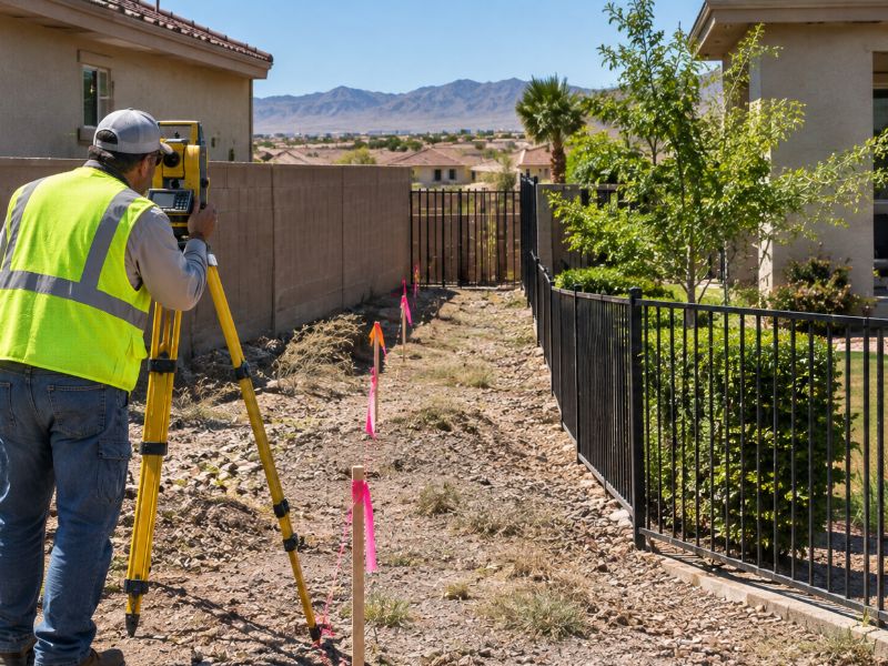
Moving a line between two parcels sounds simple on paper. Two owners agree, sign a document, and the lots change shape. In practice, the new line has to be built on accurate facts about where the old lines are, what sits near them, and who has rights across them. A boundary line survey gives both owners that foundation, and starting with one is the surest way to keep a property line adjustment from stalling at review or causing problems later.
A property line adjustment, sometimes called a lot line adjustment or boundary adjustment, shifts a shared line between neighboring parcels without creating a new lot. Owners use it to fix a structure that crosses a line, add yard space, square up an odd lot, or prepare land for development. The exact approval process can vary by city, county, and project scope, so check local rules before you commit to a timeline.
Confirming Existing Parcel Boundaries Before an Adjustment
You can’t move a line accurately until you know where it sits today. The first step is a boundary line survey of each parcel involved, or of the shared line and the lots around it. The surveyor finds existing corner monuments, measures them, and compares them to the record.
Owners are often surprised by what this step turns up. Fences, walls, and driveways may not match the true line. Corner pins can be missing or disturbed from past grading or construction, which is common on lots that have been built out or rebuilt over time.
Share any surveys, plats, or title documents you already have. They help the surveyor start faster, though the corners will still be checked in the field. If the existing lines have problems, it’s far better to learn about them now than after the adjustment is filed.
Comparing Deeds, Plats, and Survey Evidence Between Parcels
Each parcel has its own paper trail, and those records don’t always agree. The surveyor reviews the deeds, recorded plats, and prior surveys for both properties. The goal is to see whether the descriptions fit together along the shared line.
Sometimes a deed describes a line that overlaps the neighbor’s deed. Other times there’s a small gap between them. Plats may have been amended, and older deeds can use measurements that don’t match modern survey methods.
Why Record Conflicts Matter
Conflicts in the records need to be understood before a new line is drawn. A gap or overlap can affect title, and a title company may raise it during review. The surveyor will explain what the evidence shows, but questions about ownership rights should go to an attorney or title professional.
Identifying Easements and Improvements Near the Proposed New Line
An easement is a right for someone else to use part of a property for a specific purpose. Common examples include utility lines, drainage paths, and shared driveways. Moving a boundary doesn’t automatically move or cancel an easement, so the survey needs to show where they are.
Improvements matter too. These are things built on the land, such as buildings, walls, pools, sheds, and paved areas. The surveyor locates improvements near the proposed line so owners can see how the change affects them.
Pay close attention to setbacks during this step. A setback is the minimum distance a structure must stay from a property line under local rules. A new line that puts an existing building too close to the boundary can create a zoning problem, even if both owners are happy with the deal. Before finalizing the line, look for:
- Utility, drainage, or access easements that cross or run along the new line
- Buildings or walls that would end up inside a required setback
- Driveways, gates, or paths that one owner would lose access to
- Drainage features that could send water onto the other parcel
Establishing the Proposed Boundary Adjustment on the Ground
Once the owners settle on a proposed line, the surveyor can mark it in the field. Temporary stakes or flags show where the new line would run. This lets everyone walk the property and see the change in real terms.
Seeing the line on the ground often leads to small adjustments. An owner might notice that a gate, tree, or utility box lands on the wrong side. It’s much easier to shift a line by a few feet at this stage than after documents are recorded.
Permanent monuments are usually set once the adjustment is approved and recorded. Timing for this can vary by jurisdiction and project. Ask your surveyor when the final corners will be set so you’re not relying on temporary flags for too long.
Preparing Survey Documentation for the Parcel Line Change
A property line adjustment needs clear documents to move forward. The surveyor typically prepares a drawing that shows the existing lines, the proposed new line, and the resulting parcel shapes. New legal descriptions for each parcel are often part of the package.
The review agency, title company, or lender may have specific format or content requirements. These can vary by county, city, property type, and lender. Confirm what’s needed before the surveyor finalizes the drawing so you don’t end up paying for revisions.
Plan for review time as well. If a sale, loan, or construction project depends on the new line, start the survey early. Delays in approval or recording can push back closings and building permits.
Frequently Asked Questions
What is a boundary line survey?
A boundary line survey locates and marks the legal limits of a property. The surveyor researches records, finds existing monuments, and measures the lines in the field. The result is a drawing that shows the property lines and nearby features. It’s often the first step before any change to a parcel line.
Do both property owners need a survey for a lot line adjustment?
In many cases, the survey covers both parcels or at least the shared line and affected corners. The adjustment changes both lots, so both sides need accurate information. Some owners split the cost of the survey. Your surveyor can explain what scope your project needs.
Does a property line adjustment remove existing easements?
Moving a line doesn’t automatically remove or relocate an easement. Easements are separate rights that usually stay in place unless formally changed. The survey should show where easements fall compared to the new line. Talk with an attorney or title company if an easement needs to be released or moved.